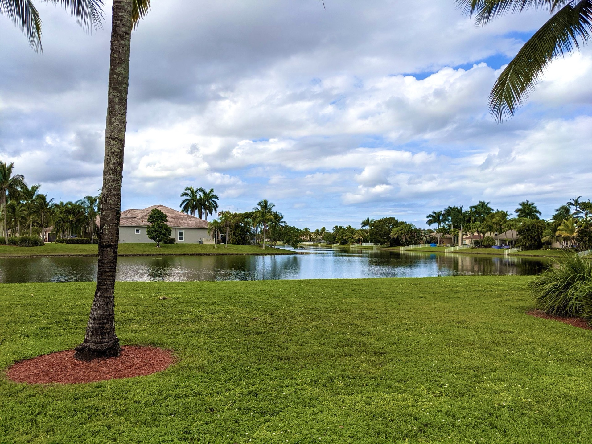
Pembroke Pines city view

Outdoors

Boating and kayaking near Pembroke Pines

Lakes, reservoirs and rivers near Pembroke Pines for boating, kayaking, canoeing and paddleboarding.

20places to boat and paddle
34 mito the closest
Year-roundbest months

Good to know: Life jackets are required for children on most waters, and many lakes require an invasive-species inspection or a launch fee.

Closest picks

1

Arthur R. Marshall Loxahatchee National Wildlife Refuge

34 mi north · Fish and Wildlife Service

The Loxahatchee National Wildlife Refuge was established in 1951 under the authority of the Migratory Bird Conservation Act of 1929 with a 50-year license agreement between the State of Florida and the U.S.
2

Biscayne National Park

36 mi south · National Park Service

Within sight of Miami, yet worlds away, Biscayne protects a rare combination of aquamarine waters, emerald islands, and fish-bejeweled coral reefs.

3

Big Cypress National Preserve

49 mi west · National Park Service

The freshwaters of the Big Cypress Swamp, essential to the health of the neighboring Everglades, support the rich marine estuaries along Florida's southwest coast.

Map of all 20 places

Map of 20 places loads as you scroll.

30 to 75 miles (6)

34 mi north · Fish and Wildlife Service

Arthur R. Marshall Loxahatchee National Wildlife Refuge

The Loxahatchee National Wildlife Refuge was established in 1951 under the authority of the Migratory Bird Conservation Act of 1929 with a 50-year license agreement between the State of Florida and the U.S.

  • Biking
  • Birding
  • Boating
  • Educational Programs
  • Fishing
  • Hiking
  • Horseback riding
  • Hunting

36 mi south · National Park Service

Biscayne National Park

Within sight of Miami, yet worlds away, Biscayne protects a rare combination of aquamarine waters, emerald islands, and fish-bejeweled coral reefs.

  • Boating
  • Camping
  • Fishing
  • Paddling

49 mi west · National Park Service

Big Cypress National Preserve

The freshwaters of the Big Cypress Swamp, essential to the health of the neighboring Everglades, support the rich marine estuaries along Florida's southwest coast.

  • Biking
  • Boating
  • Camping
  • Fishing
  • Hiking
  • History
  • Hunting
  • Paddling

57 mi southwest · National Park Service

Everglades National Park

Established in 1947 as the first national park created for its biodiversity, Everglades National Park protects 1.5 million acres of wetland, forest, and marine habitats and the native plants and animals that call it home.

  • Biking
  • Boating
  • Camping
  • Fishing
  • Hiking
  • Paddling
  • Picnicking
  • Wildlife viewing

65 mi northwest · US Army Corps of Engineers

Lake Okeechobee

As lake, waterway and surrounding countryside, Okeechobee shows the many faces of Florida. A canopy of moss-draped live oaks hides clusters of sabal palms. A tangle of water plants marks the boundary where wetland meets lakeshore.

  • Boating
  • Camping
  • Fishing
  • Hiking
  • Hotel/Lodge/Resort Privately Owned
  • Nature education
  • Picnicking
  • Water sports

66 mi north · Bureau of Land Management

Jupiter Inlet Lighthouse Outstanding Natural Area

The Jupiter Inlet Lighthouse Outstanding Natural Area (ONA) is part of the Bureau of Land Management’s 27-million acre National Conservation Lands; and the only complete unit east of the Mississippi River.

  • Boating
  • Diving
  • Hiking
  • History
  • Nature education
  • Paddling
  • Photography
  • Picnicking

75 miles and farther (14)

76 mi north · US Army Corps of Engineers · Campground

St Lucie South

St. Lucie Campground provides a relaxing camping experience on the St. Lucie Canal, part of the 152 mile Okeechobee Waterway that spans South Florida from the Atlantic Ocean to the Gulf of Mexico.

  • Birding
  • Boating
  • Camping
  • Canoeing
  • Fishing
  • Hiking

78 mi west · Fish and Wildlife Service

Ten Thousand Islands National Wildlife Refuge

Ten Thousand Islands National Wildlife Refuge was established in 1996 under provisions of the Arizona-Florida Land Exchange Act of 1988.

  • Biking
  • Birding
  • Camping
  • Fishing
  • Hiking
  • Hunting
  • Non-Motorized Boating
  • Wildlife viewing

87 mi west · National Oceanic and Atmospheric Administration

Rookery Bay National Estuarine Research Reserve

An amazing world exists within the pristine mangrove-fringed waterways, uplands and freshwater wetlands that can be found only a few miles away from downtown Naples.

  • Boating
  • Camping
  • Diving
  • Hiking
  • History
  • Paddling
  • Photography
  • Ranger programs

100 mi northwest · US Army Corps of Engineers · Campground

W.P. Franklin N

Visitors flock to W.P. Franklin Campground for its well-kept facilities and location on the Caloosahatchee River, where campers can fish, boat and take it easy in sunny southwest Florida.

  • Birding
  • Boating
  • Camping
  • Fishing
  • Kayaking

100 mi northwest · US Army Corps of Engineers · Campground

W.P. Franklin South Recreation Area

WP Franklin South Recreation Area is a day use area located on the Caloosahatchee River adjacent to the WP Franklin Lock and Dam.

  • Boating
  • Camping
  • Canoeing
  • Fishing
  • Kayaking
  • Picnicking

104 mi northwest · Fish and Wildlife Service

Caloosahatchee National Wildlife Refuge

The refuge was established by President Woodrow Wilson on July 1, 1920, through Executive Order 3299 as a ". . . preserve and breeding ground for native birds" upon the recommendation of Thomas and Mina Edison.

  • Boating

110 mi west · Fish and Wildlife Service

Matlacha Pass National Wildlife Refuge

The islands contain two basic vegetative zones, upland sand ridges and mangroves. Several islands of the Matlacha Pass NWR are used as roosting and nesting sites for a variety of colonial water birds including the brown pelican, great…

  • Boating

114 mi southwest · Fish and Wildlife Service

National Key Deer Refuge

NATIONAL KEY DEER REFUGE The National Key Deer Refuge was established in 1957 to protect and preserve the national interest the Key deer and other wildlife resources in the Florida Keys.

  • Boating
  • Ranger programs

117 mi west · Fish and Wildlife Service

J.N. "Ding" Darling National Wildlife Refuge

J.N. "Ding" Darling National Wildlife Refuge, on the subtropical barrier island of Sanibel in the Gulf of America along Florida’s west coast, is part of the largest undeveloped mangrove ecosystem in the United States.

  • Biking
  • Birding
  • Boating
  • Educational Programs
  • Fishing
  • Hiking
  • Motor Boat
  • Nature education

123 mi southwest · National Oceanic and Atmospheric Administration

Florida Keys National Marine Sanctuary

As soon as you step into the waters of the Florida Keys, you have entered Florida Keys National Marine Sanctuary.

  • Boating
  • Diving
  • Fishing
  • History
  • Paddling
  • Photography
  • Ranger programs
  • Snorkeling

125 mi north · Fish and Wildlife Service

Pelican Island National Wildlife Refuge

Pelican Island National Wildlife Refuge (NWR) is situated in the Indian River Lagoon estuary, which runs 156 miles down Florida’s eastern coastline.

  • Birding
  • Boating
  • Fishing
  • Hiking
  • Motor Boat
  • Nature education
  • Non-Motorized Boating
  • Photography

126 mi west · Fish and Wildlife Service

Pine Island National Wildlife Refuge

The Pine Island NWR is located on the southwest coast of Florida, north of Sanibel Island in the Pine Island Sound. It is administered as part of the J.N. "Ding" Darling NWR.

  • Boating
  • Fishing

127 mi southwest · Fish and Wildlife Service

Great White Heron National Wildlife Refuge

Great White Heron National Wildlife Refuge was established in 1938 as a haven for great white herons, migratory birds, and other wildlife.

  • Boating
  • Paddling

129 mi northwest · Fish and Wildlife Service

Island Bay National Wildlife Refuge

On the refuge, beaches and shores of the refuge provide loafing and feeding sites for shorebirds, gulls, and terns. The surrounding shallow bays provide valuable feeding areas for the wading and water birds.

  • Boating
  • Paddling

Distances are straight-line miles from downtown Pembroke Pines. Listings come from Recreation.gov’s federal recreation database; check each official page for hours, fees, fire restrictions and closures before you go.

Get outside around Pembroke Pines

Things to do in Pembroke Pines, Florida video thumbnail

THINGS TO DO · YOUTUBE SHORT

Things to do in Pembroke Pines, Florida

An activity Short shared by ThingssToDo.

Watch on YouTube ↗
Pembroke Pines Florida Travel Guide: Best Things to Do In 2026 video thumbnail

THINGS TO DO · YOUTUBE SHORT

Pembroke Pines Florida Travel Guide: Best Things to Do In 2026

An activity Short shared by PrimeXExplore.

Watch on YouTube ↗

Around Pembroke Pines

C. B. Smith Park, Pembroke Pines
C. B. Smith ParkLittleT889 · CC BY-SA 4.0
Perry N52CY-108 Yak-52 JTPI 8x12, Pembroke Pines
Perry N52CY-108 Yak-52 JTPI 8x12 2324 (26803835525)JTOcchialini · CC BY-SA 2.0
Perry N5188G TL-19A 51-7457 Bird Dog JTPI 8x12, Pembroke Pines
Perry N5188G TL-19A 51-7457 BirdDog JTPI 8x12 2313 (26200333353)JTOcchialini · CC BY-SA 2.0

More outdoors near Pembroke Pines

Questions

Where is the closest place for boating & paddling near Pembroke Pines?

Arthur R. Marshall Loxahatchee National Wildlife Refuge (Fish and Wildlife Service), about 34 miles north of Pembroke Pines as the crow flies. Next are Biscayne National Park (36 mi) and Big Cypress National Preserve (49 mi).

When is the best time for boating & paddling near Pembroke Pines?

Based on Pembroke Pines’s average highs, all year. Conditions at higher elevations can be much cooler.

Who manages these places?

Federal agencies including Fish and Wildlife Service, US Army Corps of Engineers, National Park Service. Each listing links to its official page for hours, fees, closures and current conditions.

Pembroke Pines AI

Your Pembroke Pines local guide
Hey there!

I'm Pembroke Pines AI. Ask about local food, shopping, history or a day out.

AI recommendations may be inaccurate. Verify hours and prices. Questions are processed by Cloudflare. Privacy